Geocirrus: Premier Geospatial Data Platform for Architects and Urban Planners
GIS SoftwareDiscover Geocirrus, the leading platform for architects and urban planners. Access high-quality geospatial data, including 3D models and LiDAR, for informed decision-making.
About GEOCIRRUS
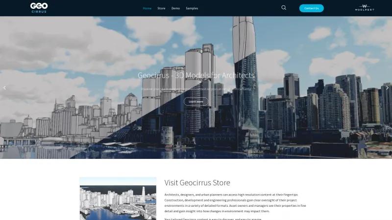
Geocirrus stands out as a premier platform for architects, urban planners, and construction professionals seeking high-quality geospatial data. The website's user-friendly interface allows for seamless navigation, making it easy to search, discover, and purchase a wide array of geospatial content. The emphasis on high-resolution 3D models, LiDAR data, and aerial imagery is particularly impressive, providing users with the detailed insights necessary for informed decision-making.
One of the most commendable aspects of Geocirrus is its commitment to quality and accuracy. The rigorous quality management processes ensure that the spatial content is not only visually stunning but also reliable for critical projects. This is crucial for professionals who rely on precise data for feasibility studies and development applications.
Moreover, the platform's adaptability is noteworthy. Geocirrus actively encourages users to request specific content types or locations, demonstrating a customer-centric approach that is often lacking in the industry. This flexibility, combined with the extensive catalog powered by Woolpert's decades of expertise, positions Geocirrus as a leader in the geospatial data market.
The high-resolution 3D mesh models and LiDAR datasets are particularly valuable for urban planning and asset management, offering actionable intelligence that enhances project outcomes. The integration of advanced technologies, such as cloud computing and AI, in data processing further underscores Geocirrus's innovative edge.
Geocirrus is an indispensable resource for anyone in the architecture, engineering, or urban planning sectors. Its combination of high-quality content, user-friendly access, and commitment to customer needs makes it a top choice for professionals aiming to elevate their projects with accurate geospatial insights. Highly recommended!
GIS Features
- 3D Imagery
- Color Coding
- Geocoding
- Image Exporting
- Internet Mapping
- Interoperability
- Labeling
- Map Creation
- Map Sharing
- Reverse Geocoding
- Spatial Analysis
Leave a review
User Reviews of GEOCIRRUS
No reviews yet.
