GVERSE GeoGraphix: Advanced Geological Interpretation and Data Management Solutions for Geoscientists and Engineers
GIS SoftwareDiscover GVERSE GeoGraphix, the ultimate suite for geoscientists and engineers. Enhance your geological analysis with advanced tools, data management, and expert support.
About GVERSE GeoGraphix
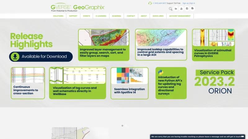
GVERSE GeoGraphix offers an impressive suite of tools and services that cater to the needs of geoscientists and engineers in the fields of geology, geophysics, and petrophysics. Their state-of-the-art geological interpretation tools facilitate detailed structure and stratigraphic analysis, while their powerful 2D and 3D seismic interpretation systems enable rapid prospect generation.
The platform's comprehensive data management and mapping capabilities, including GeoAtlas and WellBase, streamline workflows and enhance productivity. Users can easily navigate through a wealth of resources, from e-learning webinars to a robust knowledge center, ensuring they have access to the latest information and best practices.
Customer support is a standout feature, with numerous testimonials highlighting the diligence and expertise of the support team. Clients have expressed appreciation for the timely and effective assistance they receive, which significantly enhances their experience with the software.
Overall, GVERSE GeoGraphix is a powerful solution for professionals in the energy sector, providing the tools and support necessary to optimize their operations and drive success. The commitment to continuous improvement, as evidenced by regular software updates and training opportunities, further solidifies its reputation as a leader in the industry.
GIS Features
- 3D Imagery
- Color Coding
- Internet Mapping
- Map Creation
- Map Sharing
- Spatial Analysis
Leave a review
User Reviews of GVERSE GeoGraphix
No reviews yet.

