Enhance Your Geospatial Projects with ArcGIS Drone2Map: The Ultimate Drone Mapping Solution
Drone Mapping SoftwareUnlock the power of drone mapping with ArcGIS Drone2Map. Process high-res imagery instantly, create 3D models, and enhance your geospatial analysis today!
About ArcGIS Drone2Map
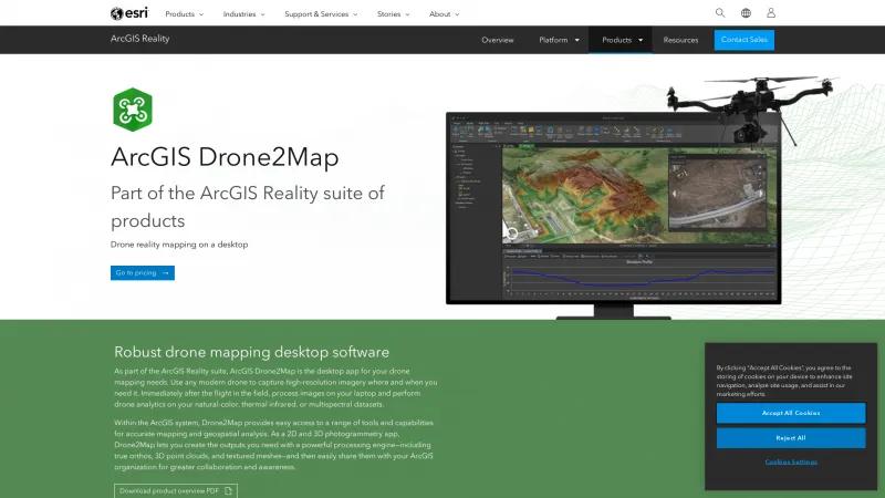
ArcGIS Drone2Map stands out as an exceptional tool for professionals in the field of geospatial analysis and mapping. As part of the comprehensive ArcGIS Reality suite, this robust desktop application offers unparalleled capabilities for both 2D and 3D photogrammetry, making it an indispensable asset for anyone involved in drone mapping.
One of the most impressive features of Drone2Map is its ability to process high-resolution imagery immediately after a flight, allowing users to conduct drone analytics on natural-color, thermal infrared, or multispectral datasets without delay. This immediacy not only enhances productivity but also ensures that critical data is available for analysis when it is most needed.
The integration with the ArcGIS system is seamless, providing users with access to a wide array of tools for accurate mapping and geospatial analysis. The ability to create true orthos, 3D point clouds, and textured meshes is a testament to the powerful processing engine behind Drone2Map. Furthermore, the outputs can be easily shared within an organization, fostering collaboration and enhancing project awareness.
The user-friendly interface allows for straightforward project management, whether in the office or the field. The option to work offline is particularly beneficial for those operating in remote areas where internet connectivity may be limited. Additionally, the built-in analytics capabilities enable users to perform detailed measurements and analyses, such as volumetric calculations and terrain profiling, with remarkable efficiency.
Case studies, such as those from Angola and Natural Development Austin LLC, illustrate the transformative impact of Drone2Map on land administration and project efficiency. These real-world applications highlight how organizations can leverage drone imagery to save time and reduce costs, ultimately leading to more effective decision-making.
ArcGIS Drone2Map is a powerful, versatile, and user-friendly solution for GIS professionals. Its robust features, seamless integration with the ArcGIS ecosystem, and ability to deliver high-quality outputs make it a top choice for anyone looking to enhance their drone mapping capabilities. Whether you are a seasoned professional or new to the field, Drone2Map is sure to elevate your geospatial projects to new heights.
Leave a review
User Reviews of ArcGIS Drone2Map
No reviews yet.
